OT 2025 SUL Actual (after action report)
- Category Weight
-
Pack, Pad, Quilt
2.14 lb
-
Kitchen
0.23 lb
-
Stove & Pot
0.2 lb
-
Electronics
0.69 lb
-
Ditty bag
0.11 lb
-
Basic First Aid Kit
0.04 lb
-
Pill and repair kit Bag
0.1 lb
-
Poop Kit
0.14 lb
-
Packed Clothes
1.11 lb
-
Consumables
6.86 lb
-
Worn Clothes
4.28 lb
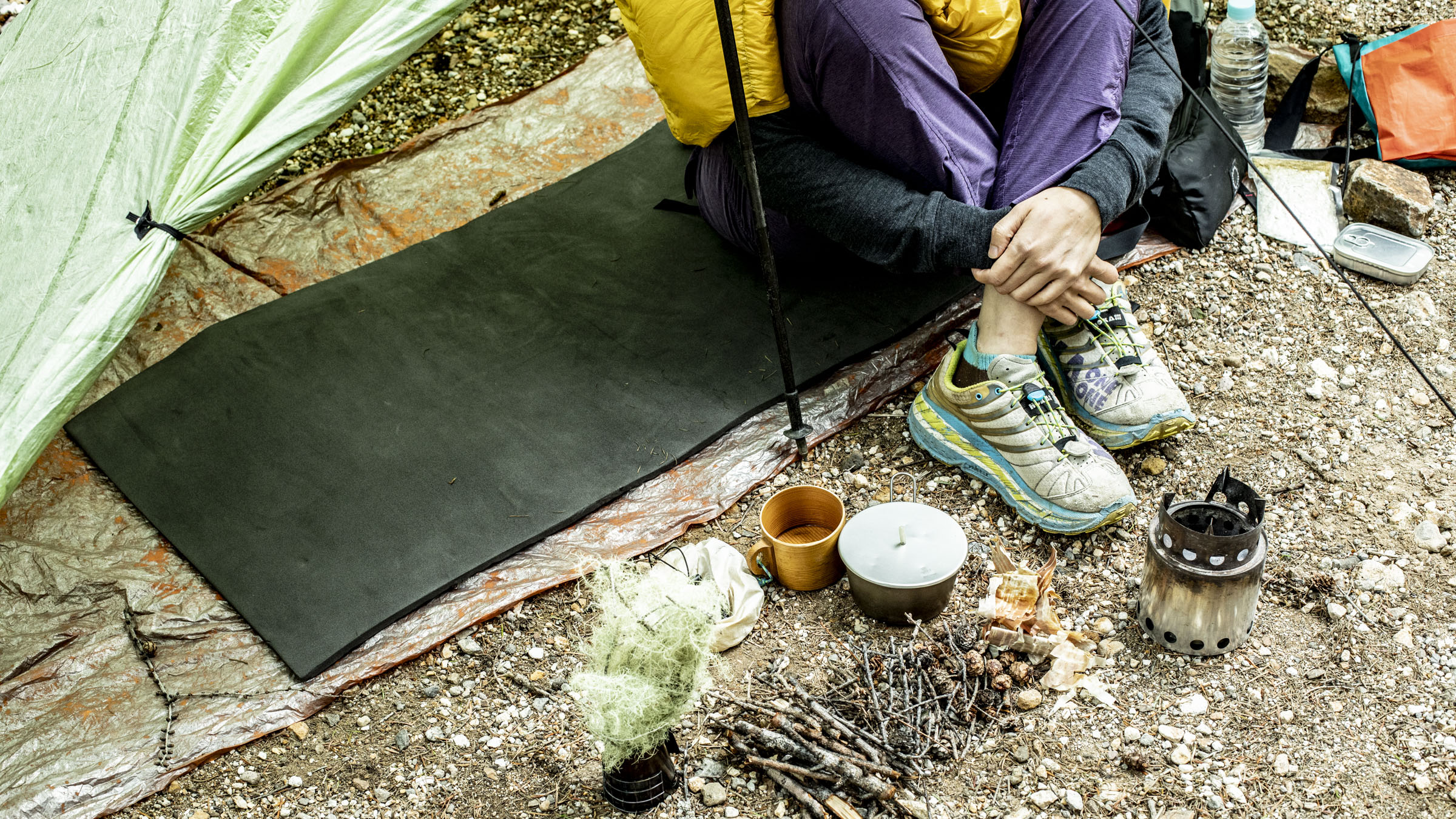
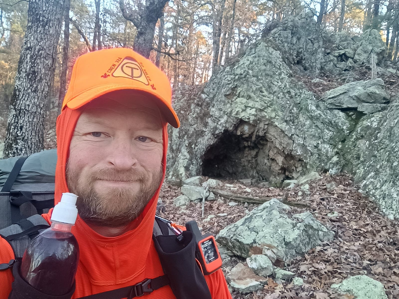
Section hike of the OT following Xmas of 2025. The hike to start at Pinnacle State park, Arkansas and continue Westbound to Arkansas Highway 7. ~ 60 miles.
Plan was to stay in established shelters each night (not bring a tent.) 5 days, 4 nights. No resupply. Meals = freeze dried for breakfast and dinner, repackaged to eliminate as much weight as possible.
Trip plan: Day 1: Pinnacles to Scott Tavin Shelter: 12.3 miles, 1364; climb Day 2: Scott Tavin Shelter to Scout Hut: 13.3 miles, 984 foot climb Day 3: Scout Hut to Browns Creek Shelter: 13.3 miles, 2367 foot climb Day 4: Browns Creek Shelter to Oak Mountain Shelter: 14.7 miles, 3082 foot climb Day 5: Oak Mountain Shelter to Arkansas 7: 6.5 miles, 900 foot climb
Weather update from Accuweather.com for Little Rock, AR as of 12/25/2025 Day 1: 12/27: High 76, Low 64, chance of rain 4%, Breezy (12-28 mph) in the morning. 76% cloud cover. (UV index 2.0 (low) Day 2: 12/28: High 67, Low 33, chance of rain 59%. Chance of thunderstorm 14%. Rain duration = 1.5 hours. Breezy (14-29 mph) with occasional rain. 98% cloud cover. UV index 1.0 low Day 3: 12/29: High 42, Low 25, chance of rain 16%. Breezy (15-25 mph). cloud cover 79%. UV index 1.0 (low) Day 4: 12/30: High 46, Low 30, chance of rain 0%. Lite wind (4-9 mph). Cloud cover 4%. UV index 3.0 (moderate) Day 5: 12/31: High 54, Low 32, chance of rain 4%. lite wind (8-16 mph). Cloud cover0%. UV index 3.0 (moderate)
Green star = item was used Yellow star = Item was used / issue with item Red star = item was not used
-
-
Pack, Pad, Quilt
Weight qty -
 Dandee SUL Pack
Dandee 30L SUL pack w/UL shock cords
209.8
g1
Dandee SUL Pack
Dandee 30L SUL pack w/UL shock cords
209.8
g1- oz
- lb
- g
- kg
-
 Yamatomichi Ul pad 15+
20"x20" section for lower legs, doubles as back pad for Dandee pack and sit pad
40.7
g1
Yamatomichi Ul pad 15+
20"x20" section for lower legs, doubles as back pad for Dandee pack and sit pad
40.7
g1- oz
- lb
- g
- kg
-
 Pad, Shortened
Nemo Switchback, 6 sections, corners rounded
162
g1
Pad, Shortened
Nemo Switchback, 6 sections, corners rounded
162
g1- oz
- lb
- g
- kg
-
 Quilt ~30F
CRO Helium w/ MYOG Mods
411.6
g1
Quilt ~30F
CRO Helium w/ MYOG Mods
411.6
g1- oz
- lb
- g
- kg
-
 Down Booties
Goosefeet Gear
59.1
g1
Down Booties
Goosefeet Gear
59.1
g1- oz
- lb
- g
- kg
-
 Pillow
Big Sky Dream Sleeper
44.8
g1
Pillow
Big Sky Dream Sleeper
44.8
g1- oz
- lb
- g
- kg
-
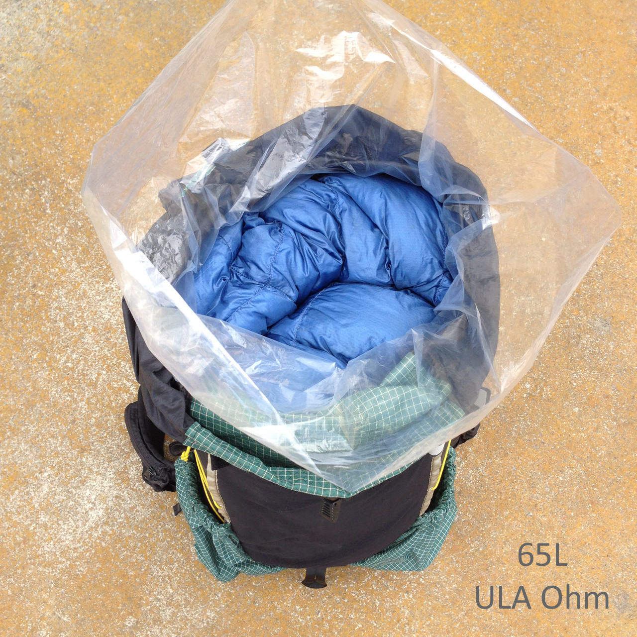 Pack Liner
Nylofume
26
g1
Pack Liner
Nylofume
26
g1- oz
- lb
- g
- kg
-
 Thermometer w/cord loop
Thermoworks
15.3
g1
Thermometer w/cord loop
Thermoworks
15.3
g1- oz
- lb
- g
- kg
-
-
-
Kitchen
Weight qty -
 Water Bottle, w/o cap
Dasani, 1L, de-labeled. With volume markings
25
g2
Water Bottle, w/o cap
Dasani, 1L, de-labeled. With volume markings
25
g2- oz
- lb
- g
- kg
-
 sports cap
4.5
g1
sports cap
4.5
g1- oz
- lb
- g
- kg
-
Dasani green cap
1.7
g1
- oz
- lb
- g
- kg
-
 Long-handled plastic spoon
McDonald's Ice Cream with drainage mod
5.5
g1
Long-handled plastic spoon
McDonald's Ice Cream with drainage mod
5.5
g1- oz
- lb
- g
- kg
-
 Bowl - ziploc - without lid
coffee & measuring cup.
24.5
g1
Bowl - ziploc - without lid
coffee & measuring cup.
24.5
g1- oz
- lb
- g
- kg
-
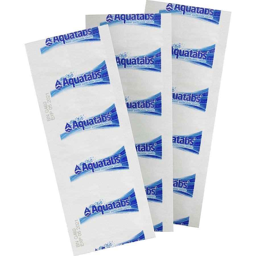 Aqua tabs
Pills/Package for 1 liter
0.25
g40
Aqua tabs
Pills/Package for 1 liter
0.25
g40- oz
- lb
- g
- kg
-
 SUL Food Sack
MYOG 0.56 OSY ripstop nylon 14"x13.5"
8.1
g1
SUL Food Sack
MYOG 0.56 OSY ripstop nylon 14"x13.5"
8.1
g1- oz
- lb
- g
- kg
-
-
-
Stove & Pot
Weight qty -
 Caldera Keg w/lip band
Trail Designs
28.4
g1
Caldera Keg w/lip band
Trail Designs
28.4
g1- oz
- lb
- g
- kg
-
 Caldera Keg top
To protect cone from crushing when packed and base for stove
6.5
g1
Caldera Keg top
To protect cone from crushing when packed and base for stove
6.5
g1- oz
- lb
- g
- kg
-
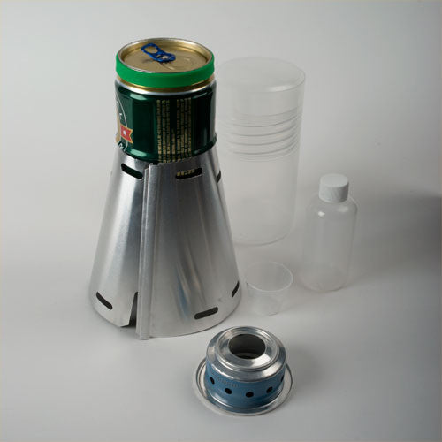 Caldera Keg Cone - Titanium
Trail Designs
34.8
g1
Caldera Keg Cone - Titanium
Trail Designs
34.8
g1- oz
- lb
- g
- kg
-
 3D printed pot grabber
3.3
g1
3D printed pot grabber
3.3
g1- oz
- lb
- g
- kg
-
 Gram cracker stove
Trail Designs
3.4
g1
Gram cracker stove
Trail Designs
3.4
g1- oz
- lb
- g
- kg
-
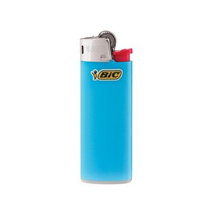 Lighter
Mini bic
11.1
g1
Lighter
Mini bic
11.1
g1- oz
- lb
- g
- kg
-
 UL bag for Caldera Keg kit
MYOG 0.56 OSY ripstop nylon
3.6
g1
UL bag for Caldera Keg kit
MYOG 0.56 OSY ripstop nylon
3.6
g1- oz
- lb
- g
- kg
-
 Snack Size Ziploc
For stove parts and lighter
1.8
g1
Snack Size Ziploc
For stove parts and lighter
1.8
g1- oz
- lb
- g
- kg
-
-
-
Electronics
Weight qty -
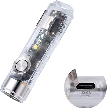 UL Flashlight
RovyVon Aurora A8x plus magnetic clip
22.3
g1
UL Flashlight
RovyVon Aurora A8x plus magnetic clip
22.3
g1- oz
- lb
- g
- kg
-
 WAPI
Sunflair
4.1
g1
WAPI
Sunflair
4.1
g1- oz
- lb
- g
- kg
-
 Phone
Motorola G Power 2023, 5k mah battery
186.9
g1
Phone
Motorola G Power 2023, 5k mah battery
186.9
g1- oz
- lb
- g
- kg
-
 Basic phone case
30.7
g1
Basic phone case
30.7
g1- oz
- lb
- g
- kg
-
 Attom Tech Battery Pack
3,000 mah
61.6
g1
Attom Tech Battery Pack
3,000 mah
61.6
g1- oz
- lb
- g
- kg
-
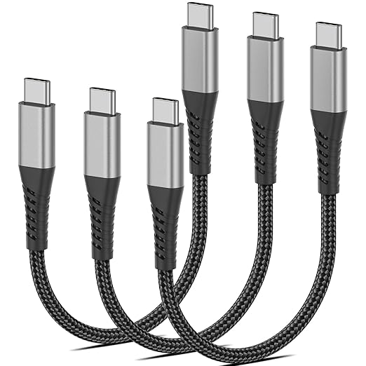 USB-C to USB-C, 6"
7.1
g1
USB-C to USB-C, 6"
7.1
g1- oz
- lb
- g
- kg
-
-
-
Ditty bag
Weight qty -
 Ditty Bag
MYOG 0.56 OSY ripstop nylon
2.9
g1
Ditty Bag
MYOG 0.56 OSY ripstop nylon
2.9
g1- oz
- lb
- g
- kg
-
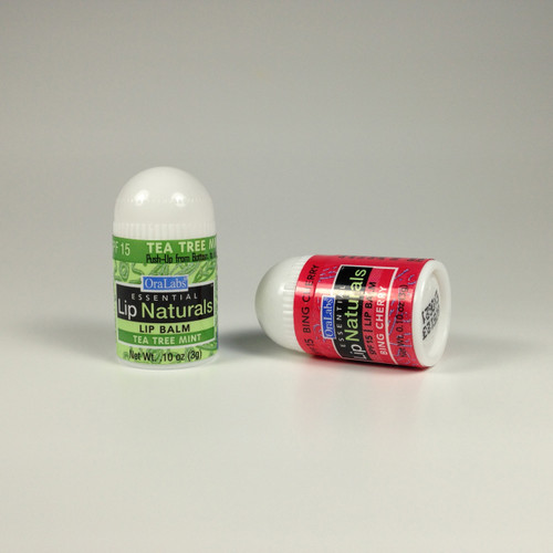 Micro Lip Balm - SPF protection
Litesmith
4.7
g1
Micro Lip Balm - SPF protection
Litesmith
4.7
g1- oz
- lb
- g
- kg
-
 Dr. Bruhners Soap
1 mL
1
g10
Dr. Bruhners Soap
1 mL
1
g10- oz
- lb
- g
- kg
-
 10 ml bottle, dropper, and cap
3.7
g1
10 ml bottle, dropper, and cap
3.7
g1- oz
- lb
- g
- kg
-
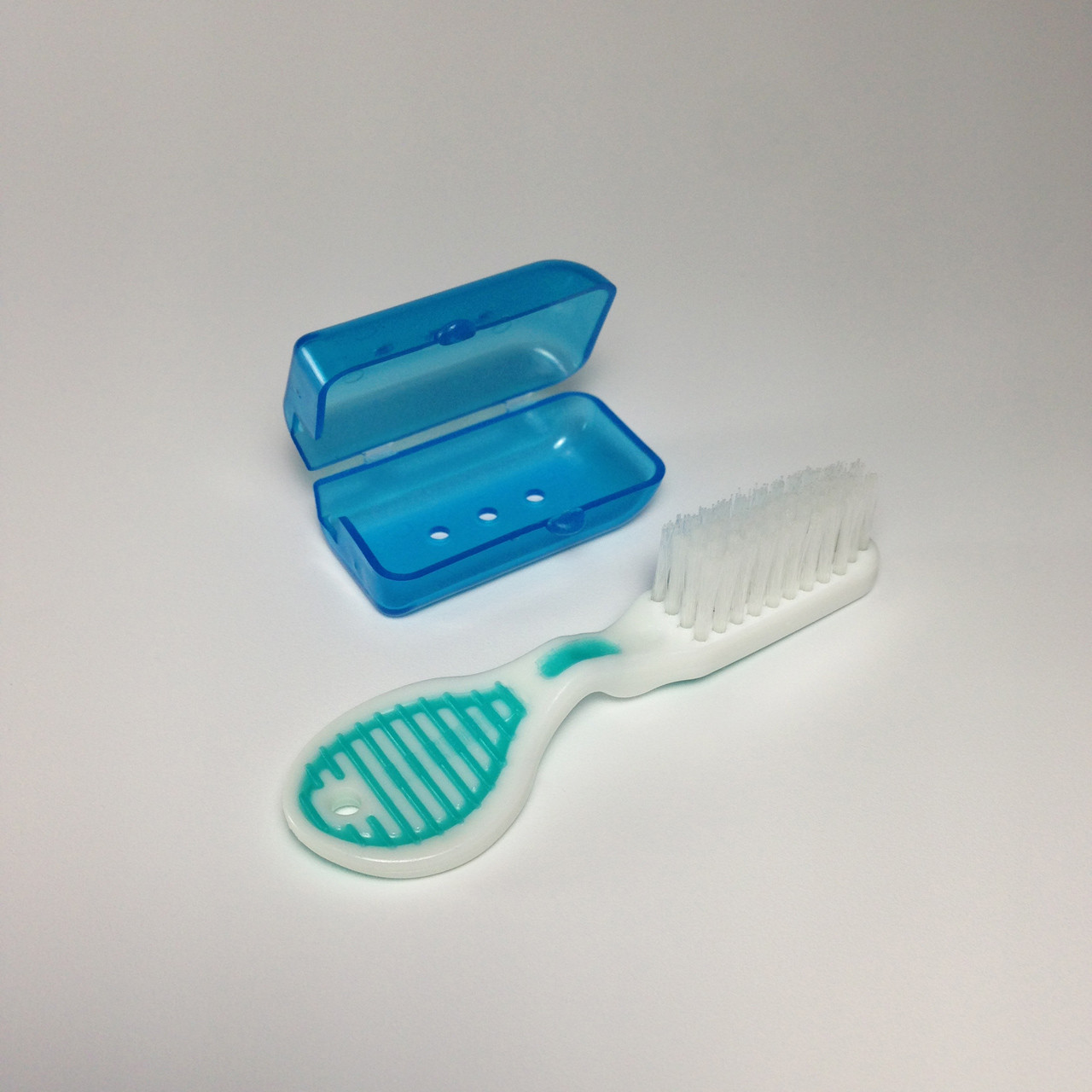 Ultralight toothbrush and case
Litesmith
6.2
g1
Ultralight toothbrush and case
Litesmith
6.2
g1- oz
- lb
- g
- kg
-
 UL Scissors
Litesmith
4.6
g1
UL Scissors
Litesmith
4.6
g1- oz
- lb
- g
- kg
-
 Floss pick
0.5
g1
Floss pick
0.5
g1- oz
- lb
- g
- kg
-
 Pack Hook with cord
Apex Giant
4.3
g1
Pack Hook with cord
Apex Giant
4.3
g1- oz
- lb
- g
- kg
-
 Drivers License
4.4
g1
Drivers License
4.4
g1- oz
- lb
- g
- kg
-
 Medical Card
2
g1
Medical Card
2
g1- oz
- lb
- g
- kg
-
 Credit/Debit Card
5.1
g1
Credit/Debit Card
5.1
g1- oz
- lb
- g
- kg
-
 UL First aid kit
See breakout category below
0
g0
UL First aid kit
See breakout category below
0
g0- oz
- lb
- g
- kg
-
 Pill Bag
See breakout category below
0
g0
Pill Bag
See breakout category below
0
g0- oz
- lb
- g
- kg
-
-
-
Basic First Aid Kit
Weight qty -
 Snack Size Ziploc
For FAK
1.8
g1
Snack Size Ziploc
For FAK
1.8
g1- oz
- lb
- g
- kg
-
 3"x3" gauze pad
3.6
g1
3"x3" gauze pad
3.6
g1- oz
- lb
- g
- kg
-
 Iodine prep pad
1.5
g1
Iodine prep pad
1.5
g1- oz
- lb
- g
- kg
-
 Alcohol Pad
0.71
g3
Alcohol Pad
0.71
g3- oz
- lb
- g
- kg
-
 BZK antiseptic towellette
2.5
g1
BZK antiseptic towellette
2.5
g1- oz
- lb
- g
- kg
-
 Qtip
0.28
g4
Qtip
0.28
g4- oz
- lb
- g
- kg
-
Pepto bismol pill
1.1
g5
- oz
- lb
- g
- kg
-
Loratadine tablet, 10 mg
Allergy Relief
0.3
g2
- oz
- lb
- g
- kg
-
laxative pill
0.17
g6
- oz
- lb
- g
- kg
-
-
-
Pill and repair kit Bag
Weight qty -
 Small Ziploc
For individual pill bags
1.5
g1
Small Ziploc
For individual pill bags
1.5
g1- oz
- lb
- g
- kg
-
 Pill bag & labels
2"x2", 2 mil
0.8
g9
Pill bag & labels
2"x2", 2 mil
0.8
g9- oz
- lb
- g
- kg
-
Benedril
0.26
g5
- oz
- lb
- g
- kg
-
Tylenol pill
650 mg
0.73
g24
- oz
- lb
- g
- kg
-
Sertraline
1/3 gram each
0.2
g5
- oz
- lb
- g
- kg
-
Alieve pill
0.33
g11
- oz
- lb
- g
- kg
-
Melatonin tablets
0.4
g5
- oz
- lb
- g
- kg
-
Toothpaste tabs
0.78
g5
- oz
- lb
- g
- kg
-
Claratin pill
0.48
g4
- oz
- lb
- g
- kg
-
Clothes drying clip
From bread bags
0.22
g9
- oz
- lb
- g
- kg
-
Needle
0.4
g2
- oz
- lb
- g
- kg
-
safety pin
0.45
g2
- oz
- lb
- g
- kg
-
Floss for sewing
0.3
g1
- oz
- lb
- g
- kg
-
Type A pad patch
0.2
g2
- oz
- lb
- g
- kg
-
Small Tennacious tape patch
0.25
g2
- oz
- lb
- g
- kg
-
2"x2" Tenacious tape patch
0.7
g1
- oz
- lb
- g
- kg
-
-
-
Poop Kit
Weight qty -
 QiWiz Trowel
Original Size
11.1
g1
QiWiz Trowel
Original Size
11.1
g1- oz
- lb
- g
- kg
-
 Holy Hiker Bidet
4.6
g1
Holy Hiker Bidet
4.6
g1- oz
- lb
- g
- kg
-
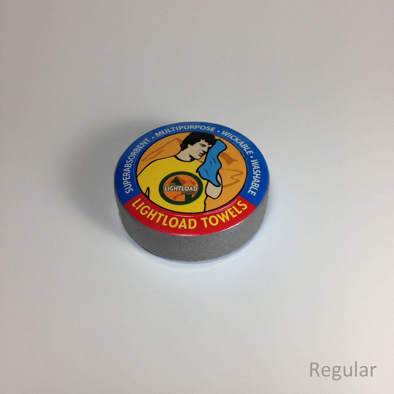 Reusable/washable TP
Small Lightload towel - used for dryoff/final clean up
7.4
g1
Reusable/washable TP
Small Lightload towel - used for dryoff/final clean up
7.4
g1- oz
- lb
- g
- kg
-
 Purell
1 milliliter
28
g1
Purell
1 milliliter
28
g1- oz
- lb
- g
- kg
-
 Purell bottle
7.8
g1
Purell bottle
7.8
g1- oz
- lb
- g
- kg
-
Long Ziploc
Poop kit bag
3.9
g1
- oz
- lb
- g
- kg
-
-
-
Packed Clothes
Weight qty -
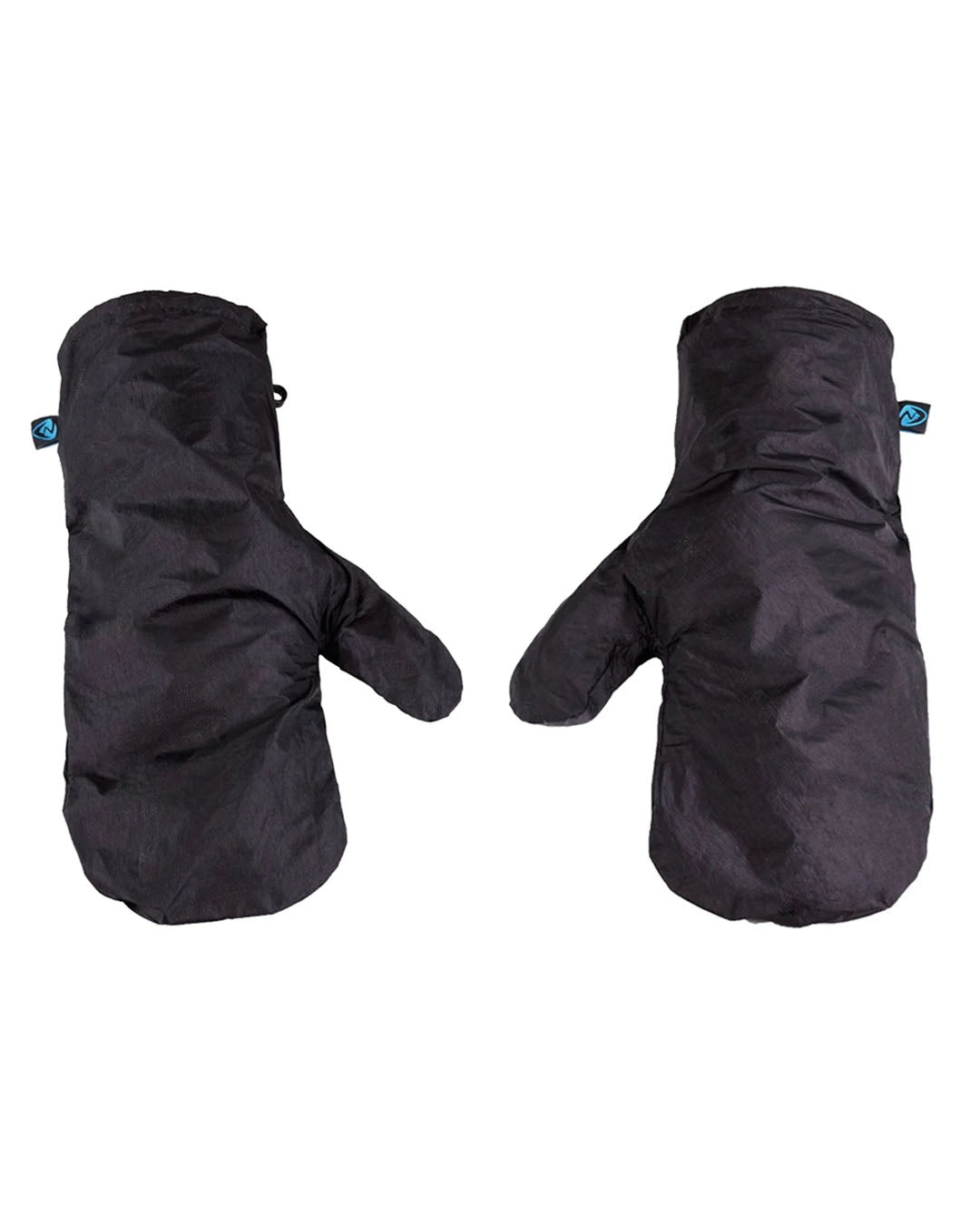 Rain Mitts / forearm protection
Zpacks Vertice plus MYOG mods
31.4
g1
Rain Mitts / forearm protection
Zpacks Vertice plus MYOG mods
31.4
g1- oz
- lb
- g
- kg
-
 Beanie
Smartwool 150 weight
41
g1
Beanie
Smartwool 150 weight
41
g1- oz
- lb
- g
- kg
-
 DCF Rainjacket
MYOG, 0.51 OSY DCF
84.5
g1
DCF Rainjacket
MYOG, 0.51 OSY DCF
84.5
g1- oz
- lb
- g
- kg
-
 DCF Rain Kilt / small groundcloth
MYOG, 0.51 OSY DCF
37.2
g1
DCF Rain Kilt / small groundcloth
MYOG, 0.51 OSY DCF
37.2
g1- oz
- lb
- g
- kg
-
 SDUL Puffy
Timmermade, SDUL 1.5, with hood
196.9
g1
SDUL Puffy
Timmermade, SDUL 1.5, with hood
196.9
g1- oz
- lb
- g
- kg
-
 Socks
Darn Tough Hiker Micro crew Cushion
62.1
g1
Socks
Darn Tough Hiker Micro crew Cushion
62.1
g1- oz
- lb
- g
- kg
-
 Glove liners
Smartwool
52.5
g1
Glove liners
Smartwool
52.5
g1- oz
- lb
- g
- kg
-
-
-
Consumables
Weight qty -
 Water
liter
1000
g1
Water
liter
1000
g1- oz
- lb
- g
- kg
-
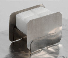
 Small Esbit
4.1
g29
Small Esbit
4.1
g29- oz
- lb
- g
- kg
-
 Cheddar Cheese Stick
22
g8
Cheddar Cheese Stick
22
g8- oz
- lb
- g
- kg
-
 Meat stick
12.5
g16
Meat stick
12.5
g16- oz
- lb
- g
- kg
-
 Ritz Crackers
Small sleeve
50.7
g4
Ritz Crackers
Small sleeve
50.7
g4- oz
- lb
- g
- kg
-
 Skittles
62
g4
Skittles
62
g4- oz
- lb
- g
- kg
-
 Chocolate Almonds
100 gram pack
18
g8
Chocolate Almonds
100 gram pack
18
g8- oz
- lb
- g
- kg
-
 Breakfast skillet, repackaged
Mountain House - 1.25 cups water
113
g3
Breakfast skillet, repackaged
Mountain House - 1.25 cups water
113
g3- oz
- lb
- g
- kg
-
 Beef Stroganoff, repackaged
Mountain House - 1.66 cups water
130
g2
Beef Stroganoff, repackaged
Mountain House - 1.66 cups water
130
g2- oz
- lb
- g
- kg
-
 Granola with milk and blueberries, Repackagedc
Mountain House - cold water
120
g1
Granola with milk and blueberries, Repackagedc
Mountain House - cold water
120
g1- oz
- lb
- g
- kg
-
 Spaghetti with meat sauce, Repackaged
Mountain House - 1.75 cups water
127
g2
Spaghetti with meat sauce, Repackaged
Mountain House - 1.75 cups water
127
g2- oz
- lb
- g
- kg
-
 Drink mix
individual packets
3
g8
Drink mix
individual packets
3
g8- oz
- lb
- g
- kg
-
 Coffee
Alpine Start
3
g8
Coffee
Alpine Start
3
g8- oz
- lb
- g
- kg
-
-
-
Worn Clothes
Weight qty -
 OT hat, Orange
74.3
g1
OT hat, Orange
74.3
g1- oz
- lb
- g
- kg
-
 Sun Glasses
Ombroz Dolemite with nose pad
26.1
g1
Sun Glasses
Ombroz Dolemite with nose pad
26.1
g1- oz
- lb
- g
- kg
-
 Sun Hoodie - Orange
Outdoor Research Echo
126.3
g1
Sun Hoodie - Orange
Outdoor Research Echo
126.3
g1- oz
- lb
- g
- kg
-
 Alpha Cruiser 60
Farpointe, 60 GSM
105.6
g1
Alpha Cruiser 60
Farpointe, 60 GSM
105.6
g1- oz
- lb
- g
- kg
-
 Copperfield Wind Shirt
Enlightened Equipment
62.5
g1
Copperfield Wind Shirt
Enlightened Equipment
62.5
g1- oz
- lb
- g
- kg
-
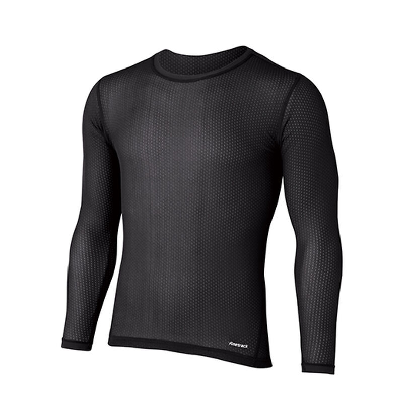 Synthetic Mesh Layer
Finetrack Elemental
73.3
g1
Synthetic Mesh Layer
Finetrack Elemental
73.3
g1- oz
- lb
- g
- kg
-
Hiking Pants, leg elastic removed Mountain Hardware Trailsender 209.8
g1- oz
- lb
- g
- kg
-
 Base Layer Bottoms
Montbell
118.3
g1
Base Layer Bottoms
Montbell
118.3
g1- oz
- lb
- g
- kg
-
 Underwear - Worn
Exofficio
74.1
g1
Underwear - Worn
Exofficio
74.1
g1- oz
- lb
- g
- kg
-
Socks
Darn Tough Hiker Micro Crew Cushion
62.4
g1
- oz
- lb
- g
- kg
-
 Trail Runners
Altra Olympus 4.0 w/superfeet green inserts
660
g1
Trail Runners
Altra Olympus 4.0 w/superfeet green inserts
660
g1- oz
- lb
- g
- kg
-
 Altimiter watch
46.4
g1
Altimiter watch
46.4
g1- oz
- lb
- g
- kg
-
 Trekking Poles
Durston Iceline with Leuko tape
303.8
g1
Trekking Poles
Durston Iceline with Leuko tape
303.8
g1- oz
- lb
- g
- kg
-